
Sound! Euphonium · Uji · Kyoto

Remember the music.
Walk through Uji.

Follow Kumiko and Reina’s Uji from the riverside to Daikichiyama. A three-stop half-day walk with a short hill climb.

Uji · Kyoto3 SPOTSAbout 3 hoursWalking + hill trail
Explore the 3-stop route
ROUTE 01宇治橋 宇治市 井川用水機場前 ベンチ 大吉山展望台
Sound! Euphonium
STORY MEMORY · UJI
Uji Bridge
REAL LOCATIONUji Bridge · UJI

THE STORY & THE TRIP

Sound! Euphonium

A story about students growing through concert band music. Uji’s riverside paths, bridge and wooded slopes connect their everyday world with a real walk.

Original novel
Ayano Takeda
Animation
Kyoto Animation
Area
Uji River · Daikichiyama
ROUTE COVERAGEUji · Kyoto · About 3 hours

Independent, unofficial guide. Public sources checked on 5 September 2026.

Original concept illustration, not an official scene or a depiction of an actual facility.
THE STORY, REIMAGINED AS A JOURNEY

Original concept illustration, not an official scene or a depiction of an actual facility.

OFFICIAL TRAILER

Meet the story before entering Tokyo.

Use the trailer to understand its mood and setting, then carry that feeling into the real Tokyo route.

Watch the official trailer on YouTube

ROUTE MAP

Three story locations along the Uji River

Start at Keihan Uji Station, visit the bridge and riverside bench, then climb to the lookout and return to the station. Allow time for breaks and the descent.

Open route in Google Maps ↗
ROUTEAbout 3 hoursWALKINGWalking + hill trailSTATUSEstimated timings · Check local guidance

3 REAL LOCATIONS

Three places to explore

Allow time for travel and breaks.

Uji Bridge
01 · Uji River
10:0020 min

STOP 01 · Uji River

Uji Bridge

Begin with the river and the town spread out before you.

STORY CONNECTION
Featured in Keihan’s official location guide. A starting point for exploring the story’s town.
ACCESS
Walk from Keihan Uji Station; JR Uji is a different station.
BEST TIME
Visit in daylight and keep bridge stops brief.
WHAT TO NOTICE
Keep the pavement clear for people crossing.
Open this location in Google Maps
Walk · about 15 min
Igawa pumping-station bench
02 · Uji riverside
10:3525 min

STOP 02 · Uji riverside

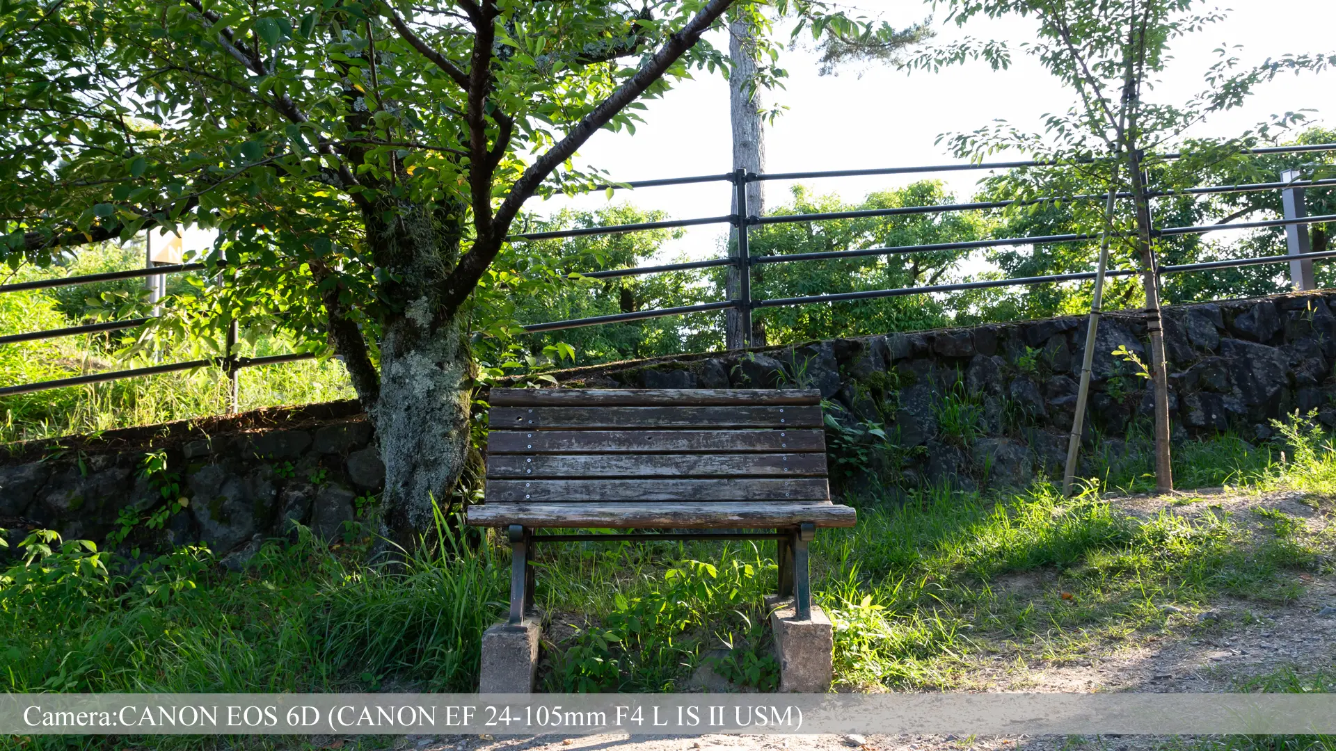
Igawa pumping-station bench

The riverside seat commonly called Kumiko’s bench.

STORY CONNECTION
Included in Keihan’s official location programme and associated with Kumiko.
ACCESS
Follow public riverside paths from the bridge.
BEST TIME
Wait your turn when busy and keep photographs brief.
WHAT TO NOTICE
Enjoy the river view without occupying the seat for a long time.
Open this location in Google Maps
Walk · about 40 min, uphill
Daikichiyama lookout
03 · Buttokusan
11:4030 min

STOP 03 · Buttokusan

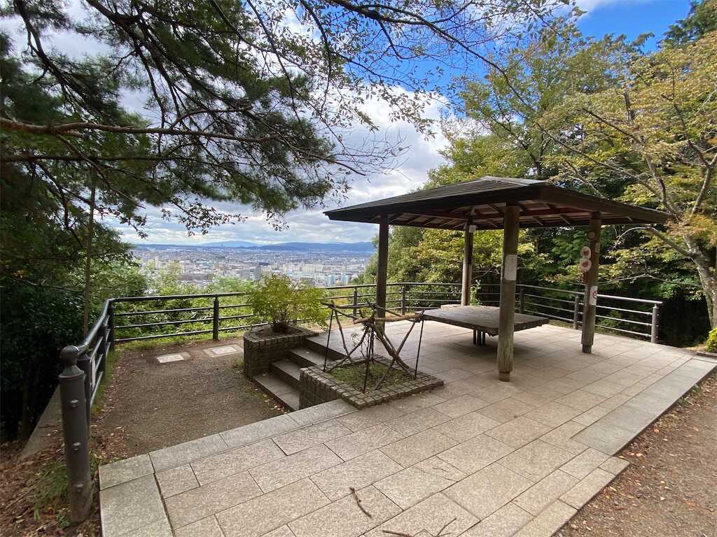
Daikichiyama lookout

A woodland climb leads to a view across Uji.

STORY CONNECTION
A lookout featured in Keihan’s official location guide, associated with Kumiko and Reina.
ACCESS
Around 20 minutes uphill from the trail entrance beyond Ujigami Shrine; descend by the same path.
BEST TIME
Complete the return in daylight; skip the climb in rain.
WHAT TO NOTICE
Bring water and walking shoes. The lookout is partway up the hill, not the summit.
Open this location in Google Maps

TRAVEL NOTES

Before you go

01Arrival

Check which Uji station you use

This route begins and ends at Keihan Uji. Add the walk to the bridge if arriving at JR Uji.

02Trail

Keep the climb to daylight

The trail includes uphill and downhill walking. In rain, visit the two riverside stops instead.

03Respect

Share everyday public spaces

Avoid long bench occupation, loud voices and instrument playing. Total time includes breaks and the descent.

Take this route into real Uji · Kyoto.

Open all 3 stops and the complete route in Google Maps.

About 3 hours · Walking + hill trail
Open route in Google Maps ↗